


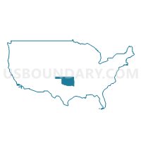
Carter, Garvin, Murray, Love & Pontotoc (West) Counties PUMA, Oklahoma
About
Outline
+Counties+PUMA%2c+Oklahoma_A280.png)
Summary
| Unique Area Identifier | 193787 |
| Name | Carter, Garvin, Murray, Love & Pontotoc (West) Counties PUMA |
| State | Oklahoma |
| Area (square miles) | 2,986.13 |
| Land Area (square miles) | 2,934.19 |
| Water Area (square miles) | 51.94 |
| % of Land Area | 98.26 |
| % of Water Area | 1.74 |
| Latitude of the Internal Point | 34.42049470 |
| Longtitude of the Internal Point | -97.25780200 |
Maps
+Counties+PUMA in Oklahoma.png)
Graphs
Select a template below for downloading or customizing gragh for Carter, Garvin, Murray, Love & Pontotoc (West) Counties PUMA, Oklahoma
+Counties+PUMA%2c+Oklahoma_T0.png)
+Counties+PUMA%2c+Oklahoma_T1.png)
+Counties+PUMA%2c+Oklahoma_T2.png)
+Counties+PUMA%2c+Oklahoma_T3.png)
+Counties+PUMA%2c+Oklahoma_T4.png)
+Counties+PUMA%2c+Oklahoma_T5.png)
+Counties+PUMA%2c+Oklahoma_T6.png)
+Counties+PUMA%2c+Oklahoma_T7.png)
+Counties+PUMA%2c+Oklahoma.png)
Neighbors
Neighoring Public Use Microdata Area (by Name) Neighboring Public Use Microdata Area on the Map
- Bryan, Pontotoc (East), Marshall, Atoka, Johnston & Coal Counties--Ada City PUMA, OK
- Grady, McClain & Pottawatomie (South) Counties PUMA, OK
- North Texas Regional Planning Commission (Outside Wichita County) & Wise County PUMA, TX
- Payne, Seminole, Creek (Southwest), Hughes & Okfuskee Counties--Stillwater City PUMA, OK
- Stephens, Caddo, Comanche (North), Tillman, Jefferson & Cotton Counties PUMA, OK
- Texoma COG--Grayson, Cooke & Fannin Counties PUMA, TX
Top 10 Neighboring County (by Population) Neighboring County on the Map
- Grayson County, TX (120,877)
- Pottawatomie County, OK (69,442)
- Grady County, OK (52,431)
- Carter County, OK (47,557)
- Stephens County, OK (45,048)
- Cooke County, TX (38,437)
- Pontotoc County, OK (37,492)
- McClain County, OK (34,506)
- Garvin County, OK (27,576)
- Seminole County, OK (25,482)
Top 10 Neighboring County Subdivision (by Population) Neighboring County Subdivision on the Map
- Ardmore CCD, Carter County, OK (36,735)
- Northwest Grayson CCD, Grayson County, TX (23,440)
- Ada CCD, Pontotoc County, OK (23,147)
- Purcell CCD, McClain County, OK (17,169)
- Pauls Valley CCD, Garvin County, OK (14,242)
- North Marshall CCD, Marshall County, OK (8,588)
- Marlow CCD, Stephens County, OK (8,477)
- East Murray CCD, Murray County, OK (8,175)
- East Love CCD, Love County, OK (7,505)
- Callisburg CCD, Cooke County, TX (5,994)
Top 10 Neighboring Place (by Population) Neighboring Place on the Map
- Ardmore city, OK (24,283)
- Ada city, OK (16,810)
- Pauls Valley city, OK (6,187)
- Lone Grove city, OK (5,054)
- Sulphur city, OK (4,929)
- Lindsay city, OK (2,840)
- Healdton city, OK (2,788)
- Davis city, OK (2,683)
- Marietta city, OK (2,626)
- Wynnewood city, OK (2,212)
Top 10 Neighboring Elementary School District (by Population) Neighboring Elementary School District on the Map
- Whitebead Public School, OK (1,502)
- Pickett-Center Public School, OK (1,204)
- Mannsville Public School, OK (1,148)
- Greenville Public School, OK (1,007)
- Zaneis Public School, OK (638)
- Byars Public School, OK (558)
Top 10 Neighboring Unified School District (by Population) Neighboring Unified School District on the Map
- Ardmore Public Schools, OK (19,155)
- Gainesville Independent School District, TX (18,333)
- Whitesboro Independent School District, TX (9,640)
- Madill Public Schools, OK (8,627)
- Byng Public Schools, OK (8,550)
- Sulphur Public Schools, OK (7,942)
- Pauls Valley Public Schools, OK (7,118)
- Callisburg Independent School District, TX (6,892)
- Plainview Public Schools, OK (6,599)
- Lone Grove Public Schools, OK (6,481)
Top 10 Neighboring State Legislative District Lower Chamber (by Population) Neighboring State Legislative District Lower Chamber on the Map
- State House District 62, TX (154,792)
- State House District 68, TX (135,942)
- State House District 49, OK (38,581)
- State House District 42, OK (37,553)
- State House District 51, OK (37,430)
- State House District 27, OK (36,934)
- State House District 22, OK (36,386)
- State House District 25, OK (36,224)
- State House District 28, OK (35,663)
- State House District 20, OK (35,429)
Top 10 Neighboring State Legislative District Upper Chamber (by Population) Neighboring State Legislative District Upper Chamber on the Map
- State Senate District 30, TX (823,594)
- State Senate District 24, OK (98,936)
- State Senate District 15, OK (87,049)
- State Senate District 6, OK (79,973)
- State Senate District 16, OK (78,677)
- State Senate District 31, OK (78,520)
- State Senate District 14, OK (76,649)
- State Senate District 28, OK (76,209)
- State Senate District 17, OK (74,685)
- State Senate District 13, OK (73,191)
Top 10 Neighboring 111th Congressional District (by Population) Neighboring 111th Congressional District on the Map
- Congressional District 26, TX (915,137)
- Congressional District 4, TX (846,142)
- Congressional District 4, OK (785,424)
- Congressional District 5, OK (749,336)
- Congressional District 2, OK (729,887)
- Congressional District 13, TX (672,781)
Top 10 Neighboring Census Tract (by Population) Neighboring Census Tract on the Map
- Census Tract 8925, Carter County, OK (9,131)
- Census Tract 7, Grady County, OK (7,465)
- Census Tract 8930, Carter County, OK (6,437)
- Census Tract 8926, Carter County, OK (6,387)
- Census Tract 7908, Murray County, OK (6,140)
- Census Tract 1, Cooke County, TX (5,892)
- Census Tract 11, Stephens County, OK (5,672)
- Census Tract 7907, Murray County, OK (5,313)
- Census Tract 6602, Johnston County, OK (5,178)
- Census Tract 886, Pontotoc County, OK (5,135)
Top 10 Neighboring 5-Digit ZIP Code Tabulation Area (by Population) Neighboring 5-Digit ZIP Code Tabulation Area on the Map
- 73401, OK (34,927)
- 74820, OK (30,802)
- 73533, OK (28,434)
- 76240, TX (26,120)
- 73055, OK (9,942)
- 73075, OK (9,519)
- 76273, TX (9,135)
- 73086, OK (8,345)
- 73446, OK (8,042)
- 73052, OK (6,315)